
About This Camera
This FAA WeatherCam on Ballyhoo Mountain monitors weather conditions for Tom Madsen Airport (PADU) at Dutch Harbor / Unalaska in the Aleutian Islands — one of the most isolated and weather-affected airports in the entire U.S. air system. Dutch Harbor sits roughly 800 miles southwest of Anchorage on Amaknak Island in the Aleutian chain; the runway is famously short (4,100 feet) and notched into the side of a mountain with water on both ends.
PADU is the home base for the Bering Sea commercial fishing fleet — featured for over a decade on the Discovery Channel series "Deadliest Catch." Dutch Harbor is the largest commercial fishing port in the U.S. by volume, processing king crab, opilio crab (snow crab), Pollock, cod, and other Bering Sea species through massive shoreside processors. The fleet supports a transient population of fishermen that swells the town's normal population of about 4,800 during fishing season.
Weather on the Aleutians is some of the most challenging on Earth for aviation. The chain sits at the convergence of the Pacific Ocean and the Bering Sea, with constant low-pressure systems generating gale and storm-force winds, low ceilings, sideways rain, and fog. PenAir (now Alaska Airlines via partnership) provides the primary scheduled passenger service with SAAB 2000 turboprops; flight cancellations and weather diversions are routine.
Alongside fishing, Dutch Harbor has significant WWII military history. The Japanese bombed Dutch Harbor in June 1942 — the only attack on the continental U.S. by Japanese forces during the war. The Aleutian World War II National Historic Area preserves the bunkers, gun emplacements, and military structures from the U.S. military buildup that followed.
Heading to Dutch Harbor (PADU)? See the weather, the light and how busy it is for yourself before you go — this is the view right now, not a photo from a brochure.
At this camera
- Location
- In Unalaska, AK
- Coordinates
- 53.9189, -166.5091
- Elevation
- 275 m (902 ft)
- Sunrise / sunset
- 9:29 AM / 8:17 PM AKDT (10 h 48 min of daylight today)
- Weather station
- PADU Dutch Harbor/Unalaska Airport, 3 km (1.9 mi) away
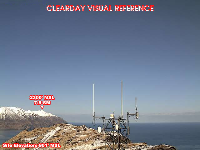
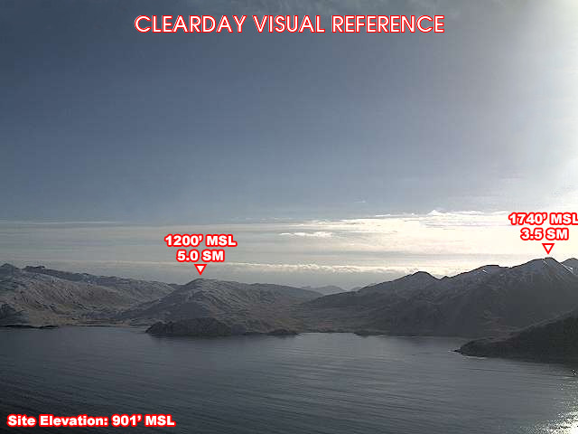
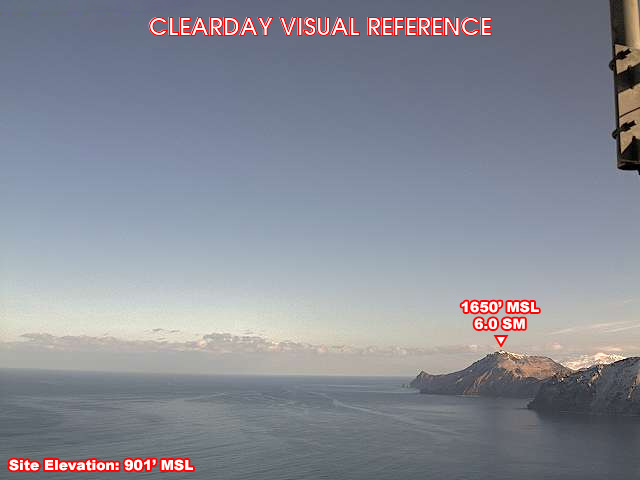
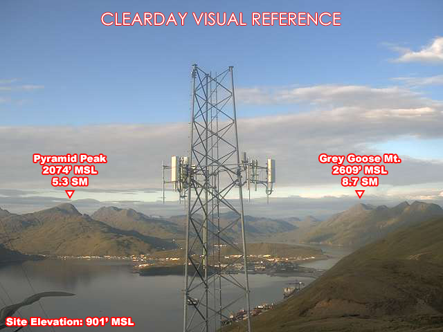
Clear-day reference views
What each camera shows on a clear day, published by the FAA. Compare with the live views above: the terrain and landmarks you can no longer see tell you how far the visibility has dropped.
All Views at Dutch Ballyhoo 4 cameras
FAA WeatherCams — PADU Auto-refresh in 300s
Fetching local weather…
7-Day Surf Outlook
Forecast data: Open-Meteo · NOAA SWPC · USGS. Conditions are estimates.
Recommended Gear


As an Amazon Associate, we earn from qualifying purchases.