
About This Camera
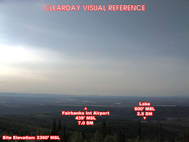
This FAA WeatherCam looks across Ester Dome toward Fairbanks International Airport (PAFA) — the major passenger and cargo gateway for Interior Alaska. Ester Dome itself is a 2,365-foot summit on the western edge of Fairbanks with broadcast towers, weather instruments, and a view that takes in the entire Tanana Valley. PAFA sits below the camera, with the surrounding subarctic boreal forest stretching to the horizon.
PAFA is the home base for Alaska Airlines' Interior routes, Ravn Alaska (regional), Northern Pacific Airways, and a robust general aviation scene. The airport is one of the few in North America where you'll routinely see ski-equipped Cessnas, Beavers, Otters, and Pilatus PC-12s parked alongside Boeing 737s — Interior Alaska runs on small-aircraft access to villages off the road system. Cargo service includes FedEx and Alaska Air Cargo.
Weather here is some of the most extreme in the lower 48 states or anywhere in the U.S. Summer temperatures can hit 95°F under 22 hours of daylight; winter temperatures regularly drop below -40°F and have hit -66°F in modern records. Ice fog forms when temperatures fall below about -30°F and visibility can drop to a few hundred feet for days. The Ester Dome view captures all of it.
Fairbanks is the cultural and economic heart of Interior Alaska — home to the University of Alaska Fairbanks, the Festival of Native Arts, the Midnight Sun Run, the World Ice Art Championships, and aurora viewing season from late August through early April. The airport is about 10 minutes from downtown, accessible by taxi, rideshare, or the Yellow Line bus.
Heading to Ester Dome (PAFA)? See the weather, the light and how busy it is for yourself before you go — this is the view right now, not a photo from a brochure.
At this camera
- Location
- In Ester, AK
- Coordinates
- 64.8759, -148.0679
- Elevation
- 731 m (2,398 ft)
- Sunrise / sunset
- 8:36 AM / 6:42 PM AKDT (10 h 6 min of daylight today)
- Weather station
- PAFA Fairbanks Intl, 12 km (7.5 mi) away
Clear-day reference views
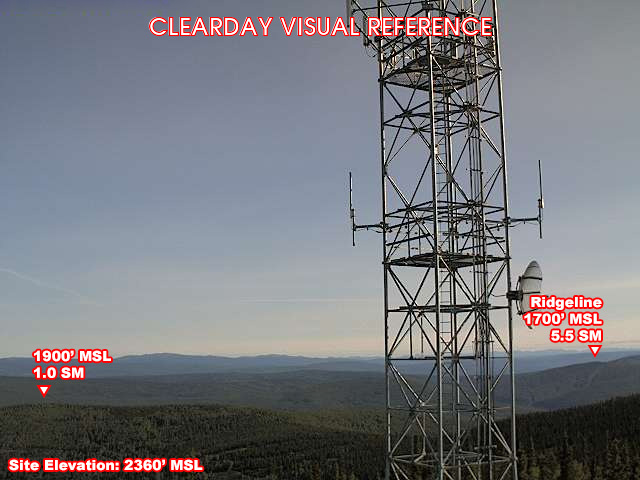
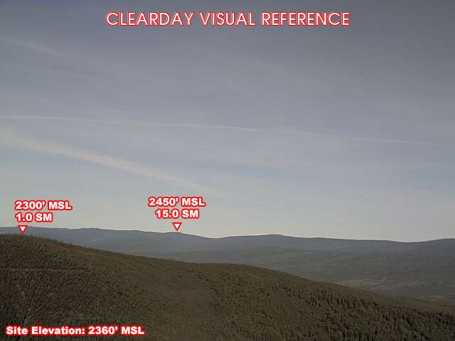
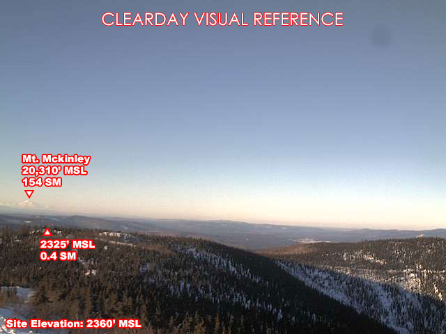
What each camera shows on a clear day, published by the FAA. Compare with the live views above: the terrain and landmarks you can no longer see tell you how far the visibility has dropped.
All Views at Ester Dome 4 cameras
FAA WeatherCams — PAFA Auto-refresh in 300s
Fetching local weather…
Extended Hourly Forecast
Forecast data: Open-Meteo · NOAA SWPC · USGS. Conditions are estimates.
Recommended Gear


As an Amazon Associate, we earn from qualifying purchases.