
About This Camera
Kodiak Airport (PADQ) serves Kodiak Island — the largest island in the United States by area outside of Hawaii — in the Gulf of Alaska. This FAA WeatherCam monitors weather for one of the most operationally challenging airports in U.S. aviation. Kodiak sits in the path of intense North Pacific weather systems; winds of 40-50 knots are routine and have hit 130+ knots during major storms. The "Kodiak willywaw" — sudden, violent downslope winds — has crashed multiple aircraft on the approaches.
PADQ is served by Alaska Airlines (daily 737 service to Anchorage) and Ravn Alaska. The airport sits adjacent to Coast Guard Air Station Kodiak — the largest Coast Guard base in the U.S. by area — which dispatches HC-130 Hercules, MH-60 Jayhawk, and MH-65 Dolphin aircraft for search-and-rescue across the entire North Pacific. You'll see Coast Guard traffic in the camera views regularly.
Weather here is everything aviators study to learn about challenging conditions. Maritime cyclones bring heavy rain, snow, and ice. Volcanic ash from the Alaska Peninsula volcanoes (Trident, Augustine, Redoubt) can disrupt operations for days. The 1912 eruption of Novarupta on the Alaska Peninsula buried Kodiak under a foot of ash in 60 hours — a possibility the local community still plans for.
The city of Kodiak (population around 5,500) is one of the largest commercial fishing ports in the U.S. by dollar value. The harbor is home to the salmon, halibut, cod, and crab fleets that supply much of the country's seafood. Visitors come for the bears (the Kodiak brown bear is the largest subspecies of brown bear on Earth), the WWII military history at Fort Abercrombie, the Russian-era Orthodox heritage, and the Crab Festival every Memorial Day weekend.
Heading to Kodiak (PADQ)? See the weather, the light and how busy it is for yourself before you go — this is the view right now, not a photo from a brochure.
At this camera
- Location
- In Kodiak Station, AK
- Coordinates
- 57.7471, -152.4926
- Elevation
- 19 m (62 ft)
- Sunrise / sunset
- 8:39 AM / 7:15 PM AKDT (10 h 37 min of daylight today)
- Weather station
- PADQ Kodiak Airport
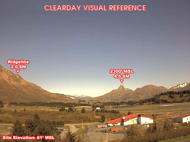
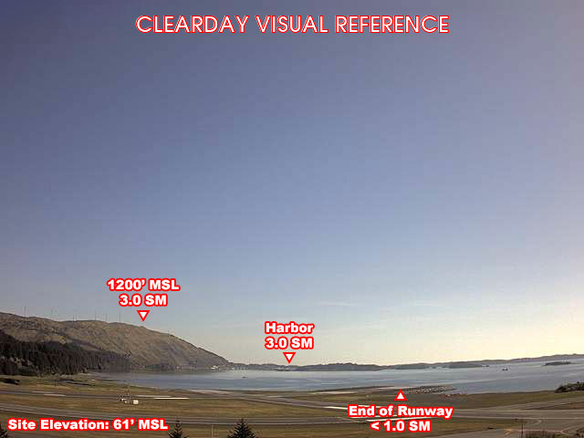
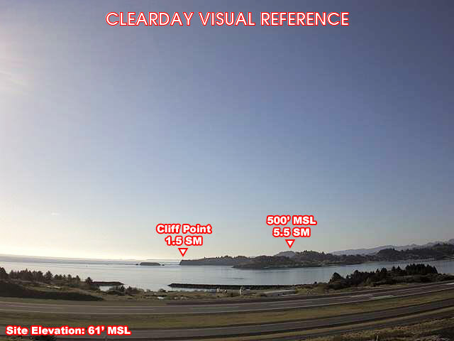
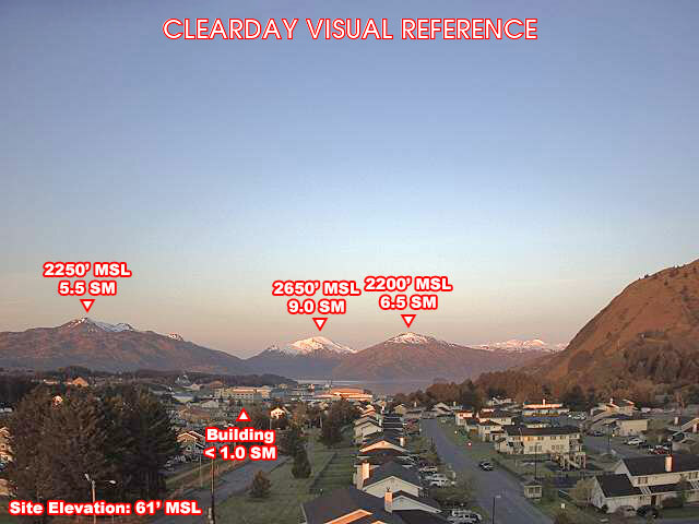
Clear-day reference views
What each camera shows on a clear day, published by the FAA. Compare with the live views above: the terrain and landmarks you can no longer see tell you how far the visibility has dropped.
All Views at Kodiak 4 cameras
FAA WeatherCams — PADQ Auto-refresh in 300s
Fetching local weather…
Extended Hourly Forecast
Forecast data: Open-Meteo · NOAA SWPC · USGS. Conditions are estimates.
Recommended Gear


As an Amazon Associate, we earn from qualifying purchases.