
About This Camera
This FAA WeatherCam at Pedersen Hill monitors weather conditions for Juneau International Airport (PAJN) — the only major U.S. capital city not accessible by road. Juneau sits in a fjord between steep coastal mountains and the Gastineau Channel, which makes both the airport approach and the city's weather among the most challenging in U.S. aviation. The Pedersen Hill camera location gives controllers and pilots a view of the cloud ceiling, fog, and visibility that defines whether flights can land.
PAJN serves Alaska Airlines (the primary carrier, with daily 737 jet service to Anchorage, Seattle, and other Southeast Alaska towns), Delta (seasonal), and Alaska Seaplanes for service to nearby Glacier Bay and outlying villages. The instrument approach is one of the most demanding in commercial U.S. aviation — Alaska Airlines pilots receive specific training for the approach into Juneau, which threads between mountain ridges to a runway with no straight-in option.
Weather around Juneau is dominated by the maritime climate of Southeast Alaska. Annual rainfall averages 62 inches at the airport (much higher in the surrounding mountains). Low ceilings, fog, and rain are common year-round; clear days are notable enough that locals comment on them. Winter brings heavy snow and the rare combination of cold and wet that ices instruments quickly.
The airport sits about 10 miles north of downtown Juneau, accessible by the Capital Transit bus or rental car (which is essential — Juneau has only about 40 miles of roads in total). The Mendenhall Glacier is visible from many parts of the airport area, and the Tongass National Forest surrounds the city completely.
Heading to Pedersen Hill (PAJN)? See the weather, the light and how busy it is for yourself before you go — this is the view right now, not a photo from a brochure.
At this camera
- Location
- In Juneau, AK
- Coordinates
- 58.3655, -134.6350
- Elevation
- 145 m (476 ft)
- Sunrise / sunset
- 7:28 AM / 6:03 PM AKDT (10 h 35 min of daylight today)
- Weather station
- PAJN Juneau Intl, 5 km (3.1 mi) away
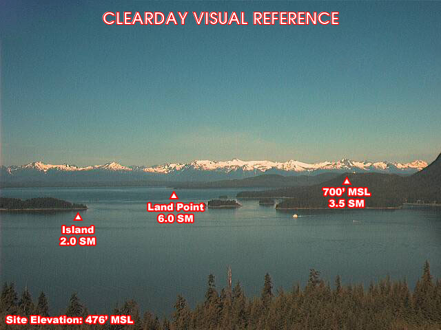
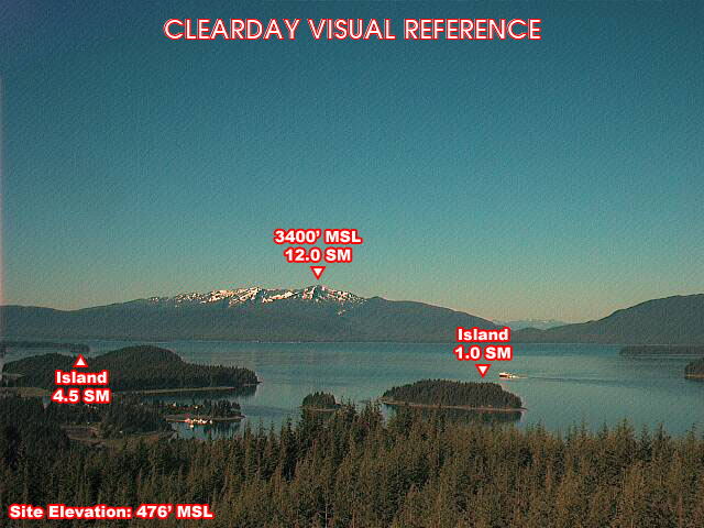
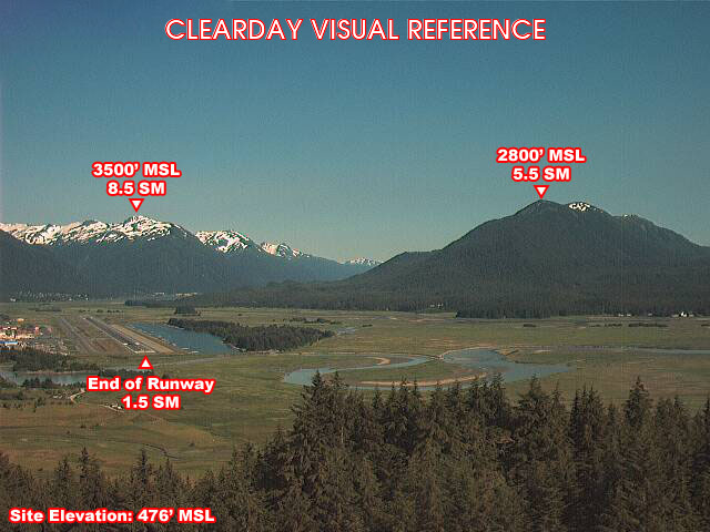
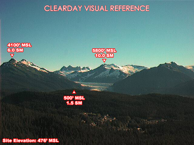
Clear-day reference views
What each camera shows on a clear day, published by the FAA. Compare with the live views above: the terrain and landmarks you can no longer see tell you how far the visibility has dropped.
All Views at Pedersen Hill 4 cameras
FAA WeatherCams — PAJN Auto-refresh in 300s
Fetching local weather…
Extended Hourly Forecast
Forecast data: Open-Meteo · NOAA SWPC · USGS. Conditions are estimates.
Recommended Gear


As an Amazon Associate, we earn from qualifying purchases.