
About This Camera
Valdez Airport (PAVD) sits at the head of Prince William Sound — one of the most spectacular fjord systems in North America, surrounded by glaciated mountains rising directly from sea level to over 10,000 feet. This FAA WeatherCam captures the dramatic maritime weather that controls flight schedules into and out of Valdez. Heavy snow, fog, freezing rain, and intense storms off the Gulf of Alaska are routine. The town itself averages 305 inches of snowfall per year; Thompson Pass just outside town holds the Alaska state record at 974.5 inches in a single winter.
PAVD is served primarily by Ravn Alaska and Alaska Airlines connections via Anchorage. The airport is the terminus of the Trans-Alaska Pipeline corridor — the Valdez Marine Terminal across the bay is where North Slope crude oil is loaded onto tanker ships for transport to refineries in California, Washington, and Hawaii. Tanker traffic in and out of Prince William Sound is a regular sight from the air.
The Chugach Mountains and Wrangell-St. Elias Mountains dominate the surrounding terrain. Heli-skiing operations from Valdez attract experienced skiers and snowboarders from around the world to the powder-rich Chugach. Salmon runs in summer bring sport and commercial fishing fleets. Wildlife visible from the air includes sea otters, harbor seals, Steller sea lions, humpback whales, orcas, and bald eagles in concentrations rarely seen elsewhere.
Visitors come to Valdez for the Worthington Glacier (visible from the Richardson Highway approach), the boat tours to Columbia Glacier and Meares Glacier, the Solomon Gulch salmon hatchery, the Valdez Museum, and the Old Town Valdez Site — the original town was destroyed in the 1964 Good Friday earthquake and rebuilt four miles away on more stable ground.
Heading to Valdez (PAVD)? See the weather, the light and how busy it is for yourself before you go — this is the view right now, not a photo from a brochure.
At this camera
- Location
- In Valdez, AK
- Coordinates
- 61.1324, -146.2506
- Elevation
- 12 m (39 ft)
- Sunrise / sunset
- 8:20 AM / 6:44 PM AKDT (10 h 24 min of daylight today)
- Weather station
- PAVD Valdez Airport
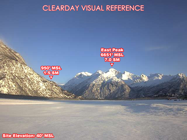
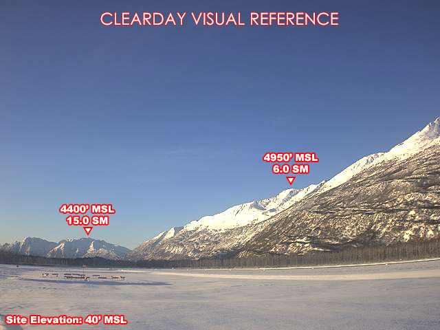
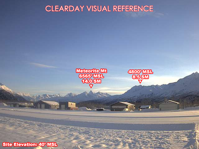
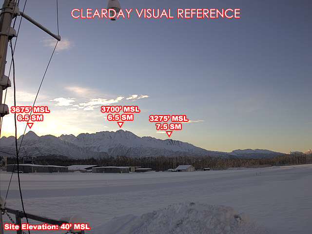
Clear-day reference views
What each camera shows on a clear day, published by the FAA. Compare with the live views above: the terrain and landmarks you can no longer see tell you how far the visibility has dropped.
All Views at Valdez 4 cameras
FAA WeatherCams — PAVD Auto-refresh in 300s
Fetching local weather…
Extended Hourly Forecast
Forecast data: Open-Meteo · NOAA SWPC · USGS. Conditions are estimates.
Recommended Gear


As an Amazon Associate, we earn from qualifying purchases.