

About This Camera
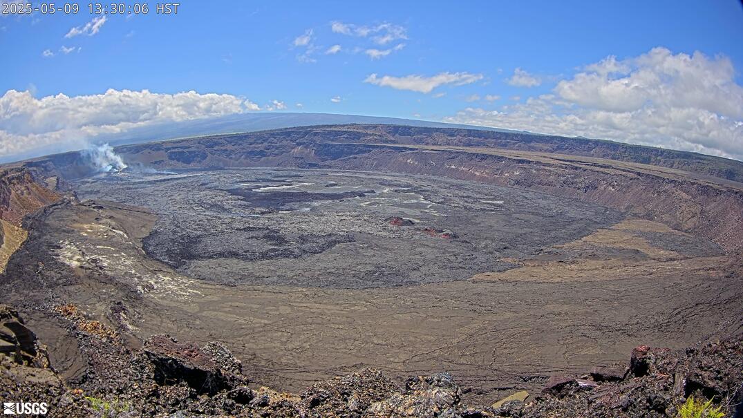
This USGS camera (KP) provides a wide panoramic view of Kīlauea's summit caldera on the Big Island of Hawaii, taking in Halemaʻumaʻu crater and the broad sweep of the surrounding caldera in a single frame. The panorama is one of the best ways to grasp the sheer scale of the volcano's summit — a caldera roughly two miles across — and to see how eruptions and collapses have reshaped it.
During eruptions the panorama can show the glow and steam of active vents across the crater, with incandescence visible at night; in quiet periods it shows the steaming, fractured caldera floor and the towering scarps from the 2018 collapse. The summit weather, near 4,000 feet, alternates rapidly between clear views, rain, and drifting vog. Hawaii observes no daylight saving time.
Maintained by the USGS Hawaiian Volcano Observatory within Hawaiʻi Volcanoes National Park, this camera is part of a continuous monitoring effort using webcams, seismic, gas, and deformation instruments. The wide view makes it a favorite for taking in the full summit landscape and for spotting the first signs of renewed activity.
Heading to Kilauea, Usgs? See the weather, the light and how busy it is for yourself before you go — this is the view right now, not a photo from a brochure.
At this camera
- Location
- 2.7 km (1.7 mi) SSW of Volcano Golf Course, HI
- Coordinates
- 19.4194, -155.2885
- Elevation
- 1,242 m (4,075 ft)
- Sunrise / sunset
- 6:15 AM / 6:01 PM HST (11 h 46 min of daylight today)
- Weather station
- PHTO Hilo Intl, 42 km (26 mi) away
‹/› Embed this camera on your website Free for any site — copy the code, keep the credit line.
The player stays live and auto-updates — no maintenance on your end. Feed problems? It falls back gracefully.
You Might Also Like
Fetching local weather…
Volcano & Seismic Activity
Forecast data: Open-Meteo · NOAA SWPC · USGS. Conditions are estimates.
Recommended Gear

As an Amazon Associate, we earn from qualifying purchases.