Live Hawaii Webcams
Watch Hawaii live across all six major islands. Oahu coverage includes Waikiki, the North Shore (Pipeline, Sunset Beach, Waimea), Lewers Street downtown, and Hawaiian Airlines' base. Maui spans Napili Kai, Lahaina coastline, and Haleakalā Crater at 10,000 feet. The Big Island features USGS Kilauea cameras, Mauna Loa Observatory, and the FAA WeatherCams at Hilo and Kona. Kauai includes Hanalei Bay and Lawai Beach Resort. Cameras update continuously with weather overlays from NOAA and the National Weather Service.
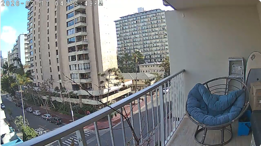
Live street cam on Lewers Street in the heart of Waikiki. Watch the bustling sidewalks, restaurants, and nightlife of Oahus most famous neighborhood.

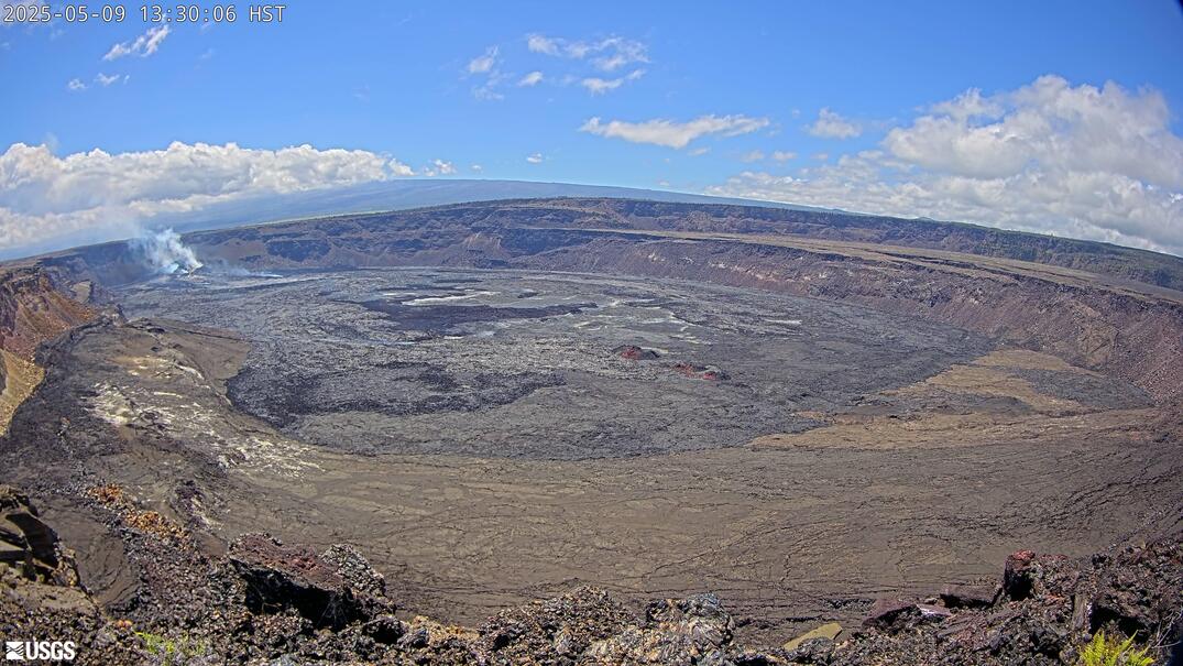
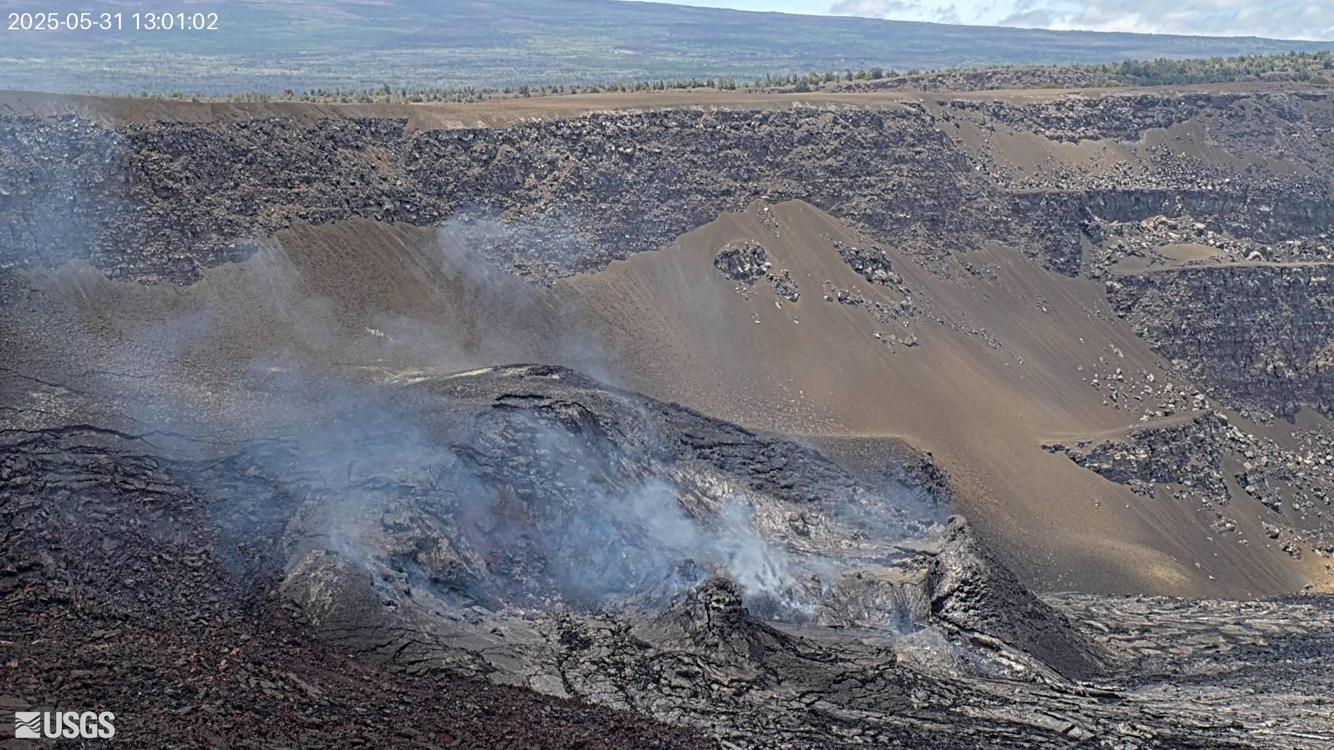
Live stream of Kīlauea Volcano's West Halemaʻumaʻu crater. Watch lava activity and volcanic events in real-time.

USGS research camera monitoring Kilauea's Halema'uma'u crater. Watch for lava glow at night, steam venting, and active volcanic activity in real time.

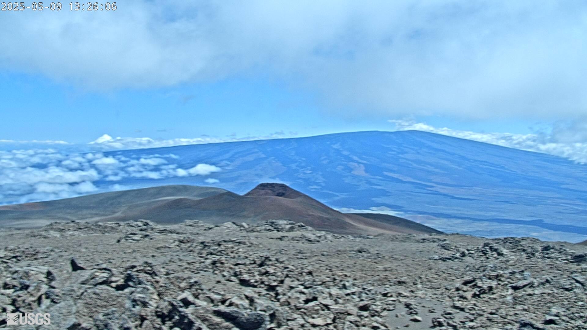
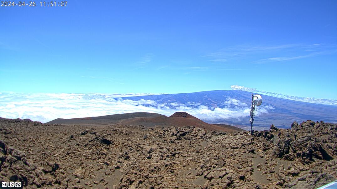
NOAA camera at the Mauna Loa Observatory looking toward Mauna Kea. Above the clouds at 11,135 feet with astronomical-quality skies and sunrise above the cloud deck.
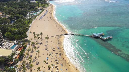
Live 4K camera overlooking Waikiki Beach — one of the most famous beaches in the world. Watch surfers, swimmers, and the sun track across Diamond Head from the heart of Honolulu.
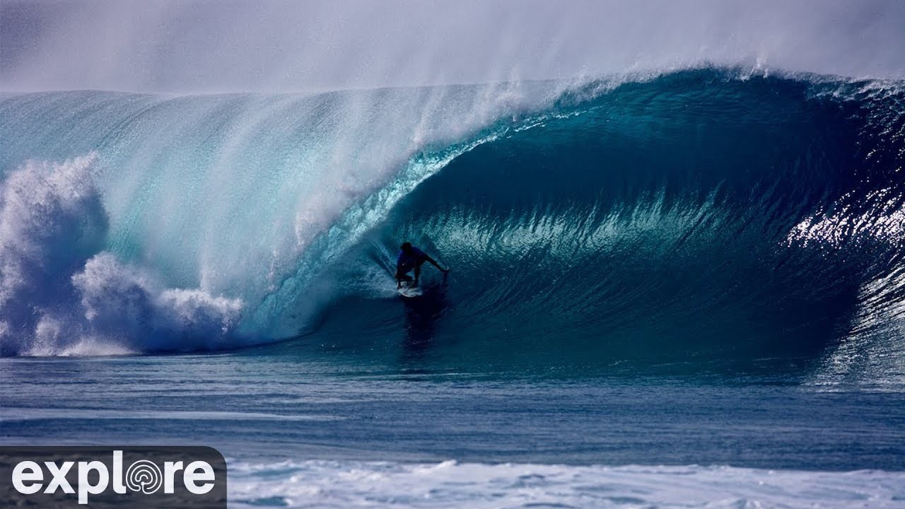
Live surf cam at the legendary Banzai Pipeline on Oahu's North Shore. World-class waves and surfers tackling one of the most famous breaks on the planet.

Live webcam from the summit of Haleakalā National Park on Maui, Hawaii. Watch the volcanic crater and stunning cloud formations above 10,000 feet.

Live geostationary satellite imagery of the Hawaiian Islands and surrounding Pacific. Updated every 10 minutes via NOAA NESDIS.
Live beach cam from the Royal Sonesta Kauaʻi Resort on Poipu Beach, Kauai's sunniest shore. Watch waves, snorkelers, sea turtles, and South Shore sunsets 24/7.
Live oceanfront webcam from the Hanalei Colony Resort on Kauai's lush North Shore. Watch Hanalei Bay with its golden sands, rolling waves, and the dramatic cliffs of the Nā Pali backdrop.

Live resort cam overlooking Ka'anapali Beach at the Sheraton Maui Resort & Spa. Watch the turquoise water, beachgoers, cliff divers at Black Rock, and West Maui sunsets in real time.
Live cam from Wailea Beach Resort on Maui's upscale south shore. Watch calm turquoise waters, whale spouts in season, and picture-perfect Maui sunsets over the Maui Channel.
Live 4K underwater and above-water cam at the Hawaiian Islands Humpback Whale Marine Sanctuary off Maui. Watch humpback whales breaching, mothers with calves, and spinner dolphins in the Au'au Channel. Peak season December–April.
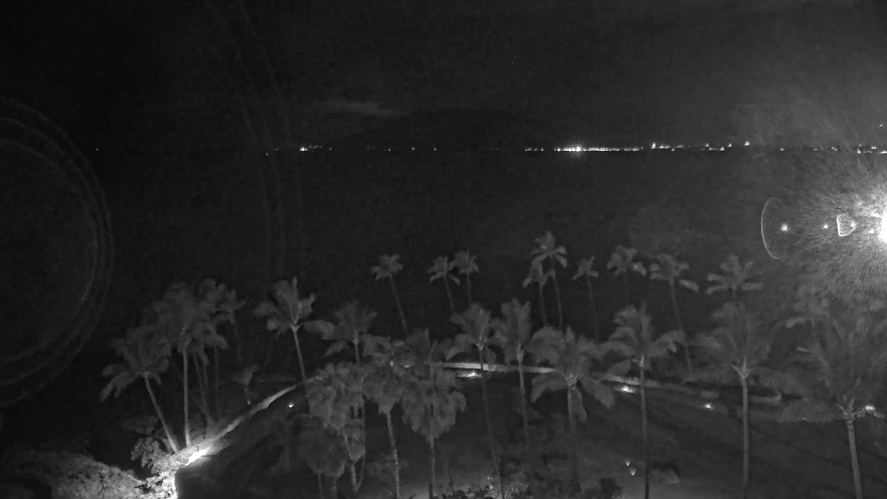
Live Hawaii beach view streaming continuously. Palm trees, ocean waves, and tropical vibes 24/7.
FAA weather camera at Kamaoa — 4 live views (Northeast, Southeast, South, West). Updated every 5-10 minutes from the FAA WeatherCams program.
FAA weather camera at Kealia — 4 live views (North, South, West, Northwest). Updated every 5-10 minutes from the FAA WeatherCams program.
FAA weather camera at Poopoomino — 4 live views (Northeast, Southeast, South, West). Updated every 5-10 minutes from the FAA WeatherCams program.
FAA weather camera at Waiopae (POA) — 4 live views (North, East, South, West). Updated every 5-10 minutes from the FAA WeatherCams program.
USGS HVO 'B1cam' monitoring Kīlauea's summit volcanic activity. Operational during heightened alert levels and live during caldera eruption episodes. Part of the USGS Hawaiian Volcano Observatory's continuous 24/7 summit surveillance network.
USGS HVO fissure camera deployed along Kīlauea's East Rift Zone during active eruptions. Shows lava outbreak areas, spatter cones, and active fissures when the rift zone opens. Went active during the catastrophic 2018 Lower East Rift Zone eruption that destroyed Leilani Estates.

USGS HVO 'HPcam' — high-position camera covering Kīlauea's summit and upper caldera. Wide-angle context shot for eruption monitoring; shows caldera geometry and steam plume direction. Part of the HVO's 24/7 summit surveillance grid covering all caldera quadrants.
USGS HVO 'K2cam' from Uekahuna Bluff, highest point on Kīlauea caldera's rim at ~4,009 ft. Elevated overlook showing the full Halemaʻumaʻu depression and lava lake depth. Above the clouds on clear mornings — dramatic wide view of the entire caldera.

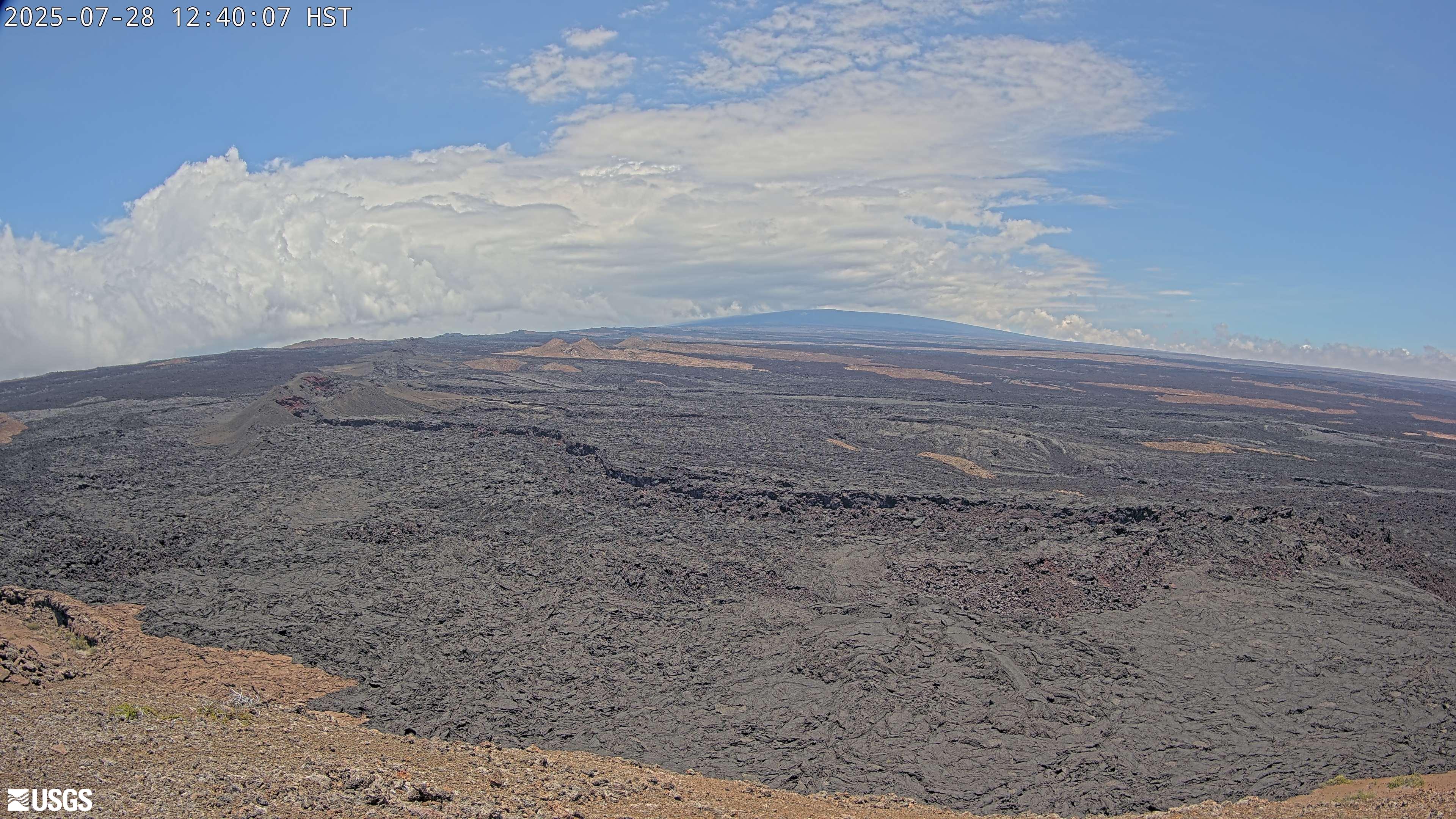
USGS HVO 'KOcam' on Kīlauea's East Rift Zone near the Mauna Ulu area. Mauna Ulu last erupted 1969–1974, producing the iconic Chain of Craters Road lava flows. Watches the rift corridor for renewed fissure activity and degassing from the 50-year-old lava field.

USGS HVO 'KWcam' covering Kīlauea's summit — companion wide-angle to the V-series cameras. Shows overall caldera floor and rift zone horizon. Useful for tracking plume direction, eruption column height, and lava visible at the caldera rim.
USGS HVO 'KPcam' scanning the Kīlauea summit caldera area near park visitor viewpoints. Pan-tilt camera that rotates to active areas during eruptions and heightened volcano unrest. Watches the caldera viewpoint area visible from the Hawaiʻi Volcanoes NP overlook.
USGS HVO camera at Kīlauea Iki, the smaller crater that drained and resolidified after a 1959 eruption. Watch steam vents rising from the hardened lava floor and hikers crossing the solidified lava lake. A striking demonstration of how fast Hawaiian volcanic surfaces are created and cool.
USGS HVO 'PEcam' east of Puʻu Pohaku on Kīlauea's summit rim. Monitors eruption activity on the eastern caldera wall and tracks lava lake level changes. Paired with PWcam to bracket the summit vent from both sides around the clock.
USGS HVO 'MUcam' on Mauna Ulu, a shield vent on Kīlauea's East Rift Zone active 1969–1974. Shows the barren lava landscape of the Chain of Craters area and any ongoing degassing from the vent. Accessible to hikers via Chain of Craters Road in Hawaiʻi Volcanoes NP.
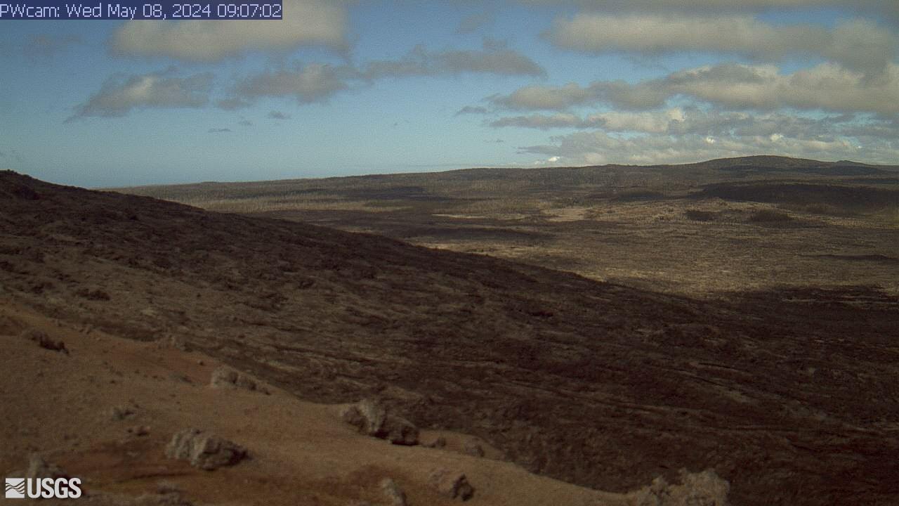
USGS HVO 'PWcam' west of Puʻu Pohaku near Kīlauea caldera. Partner to PEcam; together they watch for fissure breakouts on both sides of the summit vent. Livestreamed continuously by the USGS Hawaiian Volcano Observatory.
USGS HVO 'S1cam' at the Sulfur Banks (Haʻakulamanu) on Kīlauea's caldera rim. Watch yellow sulfur deposits, steam venting, and colorful hydrothermal alteration of the volcanic rock. One of the few spots where volcanic gases are visible year-round, even between eruptions.

USGS HVO 'V1cam' on the west rim of Halemaʻumaʻu crater — the primary eruption-watch angle. Captures lava fountain activity and spattering directly below the crater wall during summit eruptions. First camera to show fissure breakouts on the western caldera wall.
USGS HVO 'V3cam' — south-facing pan-tilt-zoom camera on Kīlauea's Halemaʻumaʻu crater. Wide view of the crater rim and outer caldera; rotates to track active venting and lava flows in real time. Particularly useful for following vent migration during multi-day eruptions.
USGS HVO 'V2cam' on the east rim of Halemaʻumaʻu crater, Kīlauea's active summit vent. Looks across the full crater floor and lava lake — catches eruption columns and spattering from the far wall. Companion to V1cam for stereo coverage of the summit vent.
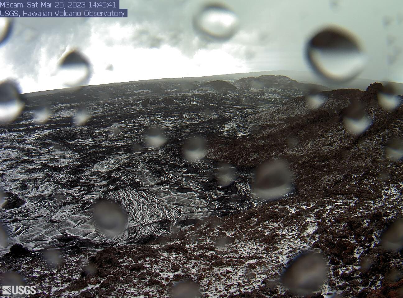
USGS HVO 'M3cam' on Mauna Loa's flanks — high-altitude monitoring above the cloud layer. The November 2022 eruption's dark lava flows are visible as fresh streaks on the older lava field. Summit rises to 13,679 ft; views above the trade-wind inversion on clear days.
USGS HVO 'M2cam' on Mauna Loa's upper flank at ~11,000 ft — Earth's most massive active volcano. High-altitude lava landscape; summit snow possible above 11,000 ft in winter. The 2022 eruption flows are visible as dark streaks on older pāhoehoe in the frame.

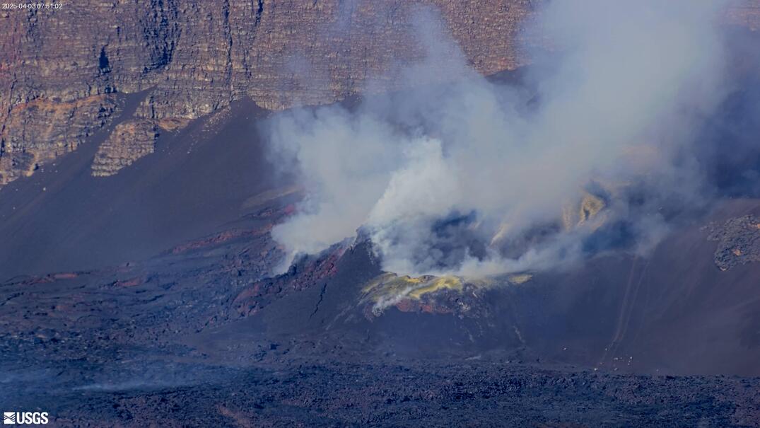
USGS HVO 'HLcam' monitoring Mauna Loa's Mokuʻāweoweo summit caldera. Earth's largest active volcano last erupted November–December 2022 — first summit eruption since 1984. Watches for renewed caldera activity and any smoke plumes from the northeast rift zone.

USGS HVO 'MDLcam' on Mauna Loa — mid-elevation monitoring of the volcano's 60-mile-long shield. Watches the summit area and Northeast Rift Zone for signs of renewed magmatic intrusion. Part of the continuous HVO surveillance network active since the observatory's 1912 founding.
USGS HVO 'MK2cam' looking at Mauna Loa from a Mauna Kea vantage. Unique cross-volcano perspective — Mauna Loa's 60-mile-long shield profile against the Pacific horizon. Shows the visual scale difference between the two highest island volcanoes on Earth.
USGS HVO 'MKcam' — Mauna Kea's view across the saddle to Mauna Loa. At 13,679 ft (Mauna Loa) and 13,796 ft (Mauna Kea), Hawaii's twin giants face each other in the frame. Both summits visible above the trade-wind cloud inversion in clear weather.
USGS HVO 'MLcam' watching Mauna Loa's Mokuʻāweoweo caldera from the summit area. During the 2022 eruption this camera captured 200-ft lava fountains and active caldera lava lakes. Now quiet — remains live and ready to document the next eruption cycle.

USGS HVO 'MSPcam' monitoring Mauna Loa's south flank and caldera approach at ~13,000 ft. Above the cloud line most days — watch sunrise turn lava fields gold and summit snowpack build in winter. Monitors the south caldera wall for ground deformation and magmatic unrest signals.

Live stream of Kīlauea Volcano's East Crater. Watch real-time volcanic activity, lava flows, and eruption events from the eastern vent area.

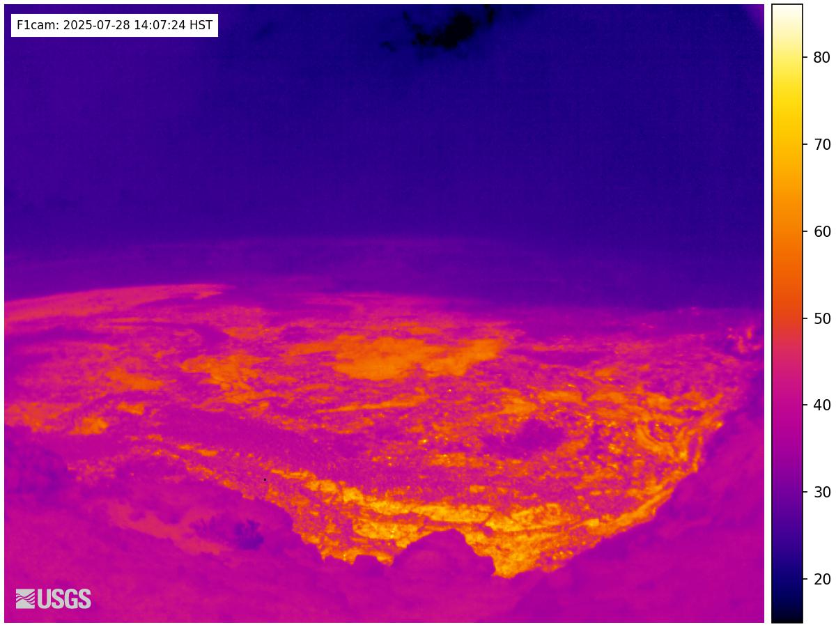
Live USGS HVO webcam — F1cam, additional Halemaʻumaʻu crater angle complementing the V1/V2/V3 series.

Live USGS HVO webcam from the Halemaʻumaʻu Perimeter. Wide-angle view capturing eruption events from the rim.

Live USGS HVO webcam from the Kilauea Overlook area. View of the historic Halemaʻumaʻu crater region.

USGS HVO pan-tilt camera scanning Kīlauea's summit caldera and Halemaʻumaʻu vent area. Rotates to active eruption zones during volcanic unrest — one of the most dynamic angles on the volcano. Covers the caldera viewpoint visible from the main Hawaiʻi Volcanoes NP overlook.

Live USGS HVO webcam from the Middle East Rift Zone of Kilauea volcano. Less-watched angle showing rift zone activity outside the summit caldera.

Live USGS HVO webcam at Mauna Ulu — the 1969-1974 eruption site on the East Rift Zone of Kilauea. Lava field landscape and ohia regrowth visible.

Live USGS HVO webcam at Puʻuʻōʻō East — the long-active vent of the 1983-2018 East Rift Zone eruption. Now collapsed, but cam shows the dramatic landscape.

Live USGS HVO webcam at Puʻuʻōʻō South. East Rift Zone monitoring; lava field landscape with native vegetation regrowth.

Live USGS HVO webcam at Puʻuʻōʻō West. East Rift Zone monitoring with views of the collapsed vent.

Live USGS HVO webcam from the Rift Zone (R3cam). Monitoring active deformation and any new vent activity.

Live USGS HVO webcam at S1cam — south rim of Halemaʻumaʻu. Companion to the V-series cams; alternate angle of summit eruption episodes.

Live stream of Kīlauea Volcano's South Caldera. Watch real-time volcanic activity and lava events from the southern vent.

Live webcam from GOES Hawaii in Hawaii.
Live webcam from Honolulu, United States.