

About This Camera
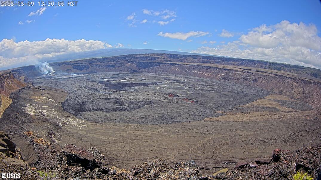
This USGS camera (PW) looks toward Puʻu ʻŌʻō from the west, on Kīlauea's East Rift Zone, Hawaii Island. Puʻu ʻŌʻō was the vent of one of the longest rift-zone eruptions in recorded history — it erupted almost continuously from 1983 to 2018, building a cone, feeding lava tubes to the sea, and burying the community of Kalapana. In 2018 the crater floor collapsed as magma drained downrift to the lower East Rift Zone eruption. The camera now watches the collapsed cone and the surrounding lava fields. Conditions along the rift range from clear to misty and vog-laden. USGS Hawaiian Volcano Observatory; Hawaii observes no daylight saving.
Heading to Kilauea, Usgs? See the weather, the light and how busy it is for yourself before you go — this is the view right now, not a photo from a brochure.
At this camera
- Location
- 2.7 km (1.7 mi) SSW of Volcano Golf Course, HI
- Coordinates
- 19.4194, -155.2885
- Elevation
- 1,242 m (4,075 ft)
- Sunrise / sunset
- 6:15 AM / 6:01 PM HST (11 h 46 min of daylight today)
- Weather station
- PHTO Hilo Intl, 42 km (26 mi) away
‹/› Embed this camera on your website Free for any site — copy the code, keep the credit line.
The player stays live and auto-updates — no maintenance on your end. Feed problems? It falls back gracefully.
You Might Also Like
Fetching local weather…
Volcano & Seismic Activity
Forecast data: Open-Meteo · NOAA SWPC · USGS. Conditions are estimates.
Recommended Gear

As an Amazon Associate, we earn from qualifying purchases.